 |
|
Several city to city plots are shown. Red lines are geodesic ( a Great circle portion ), while blue lines are straight.
Images generated by Carlos Furuti. Notice how a square with edges of 1000 kilometers would appear in these different projection systems. 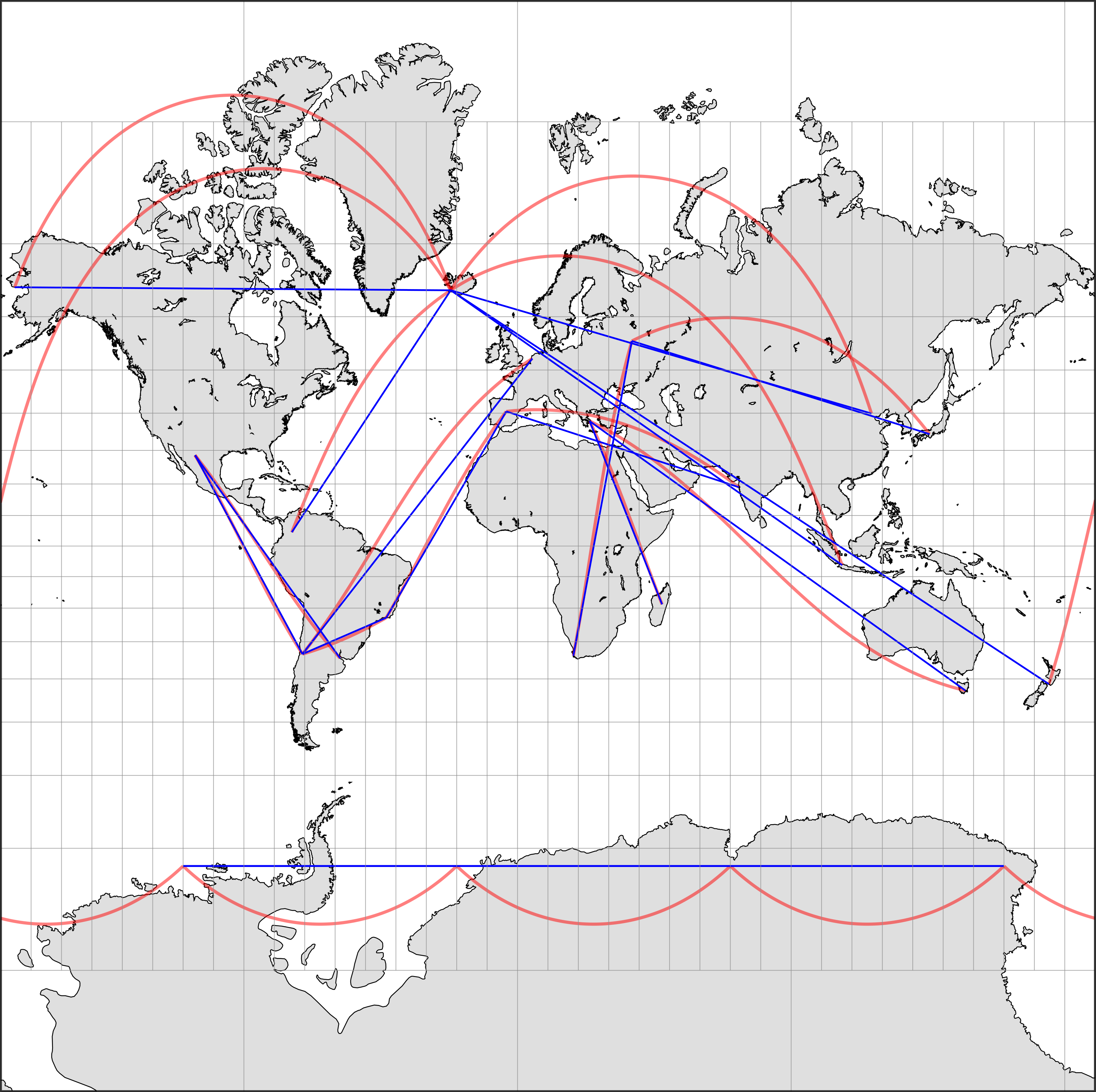 Mercator 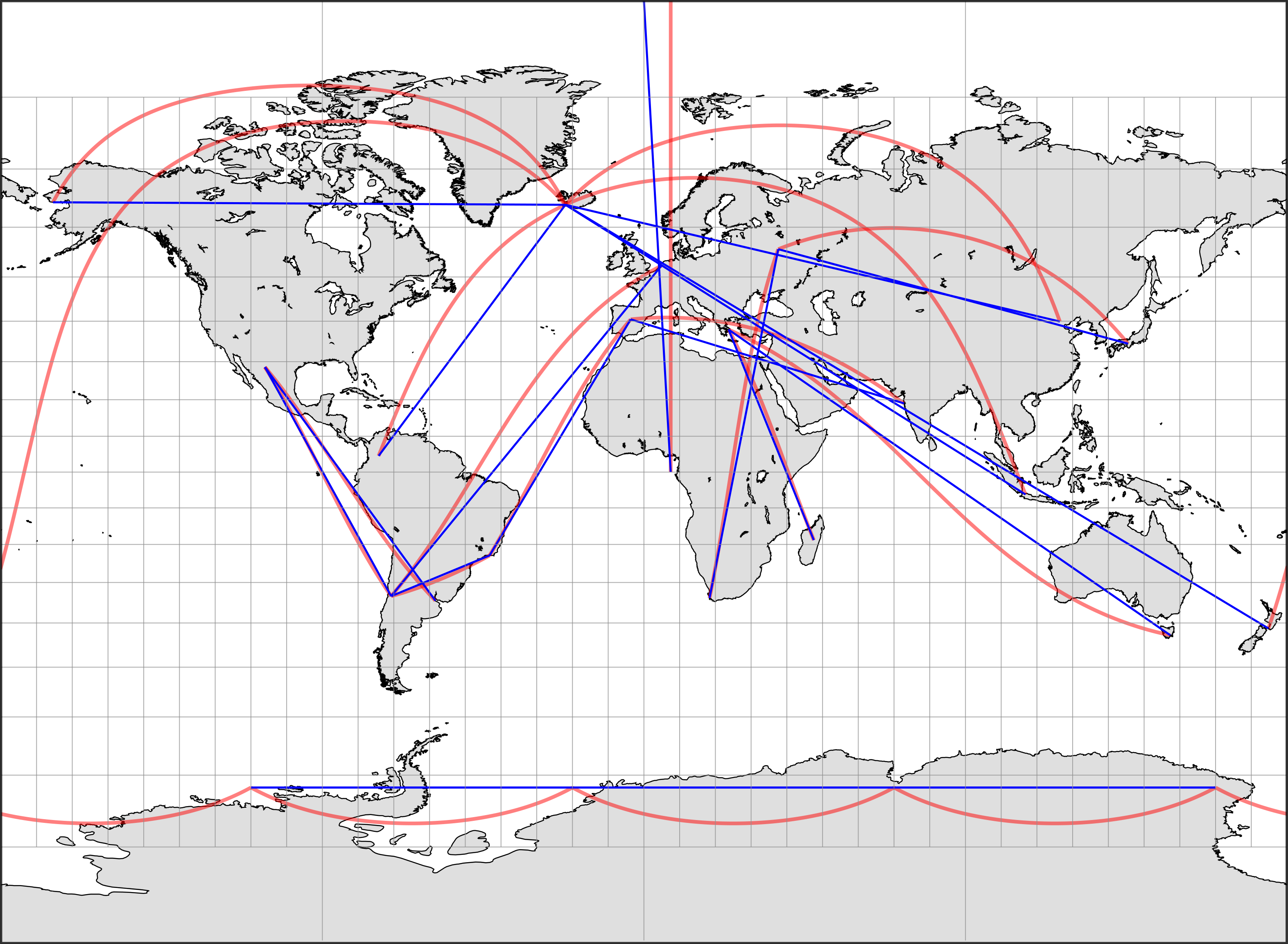 Miller 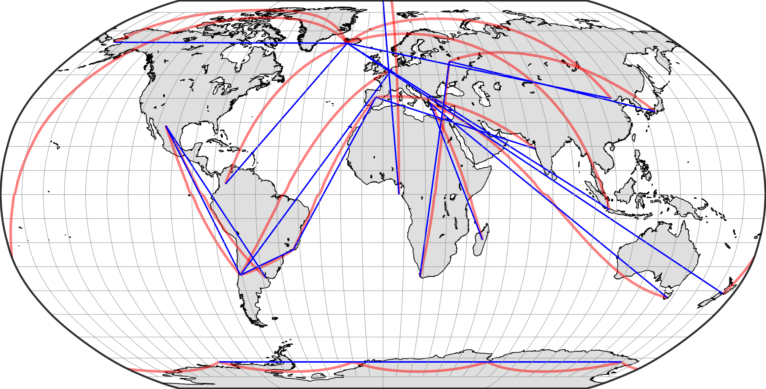 Robinson 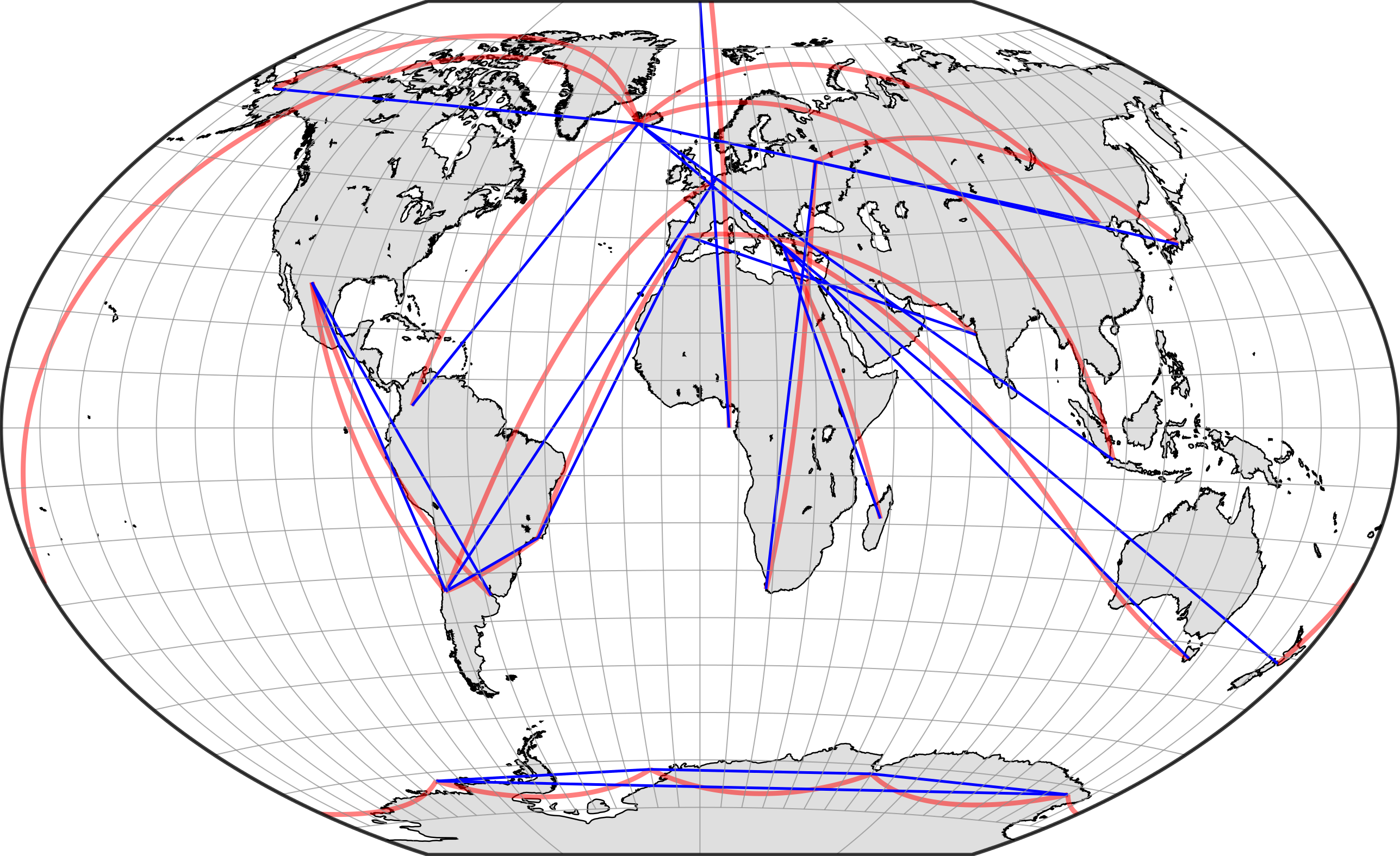 Winkel-tripel 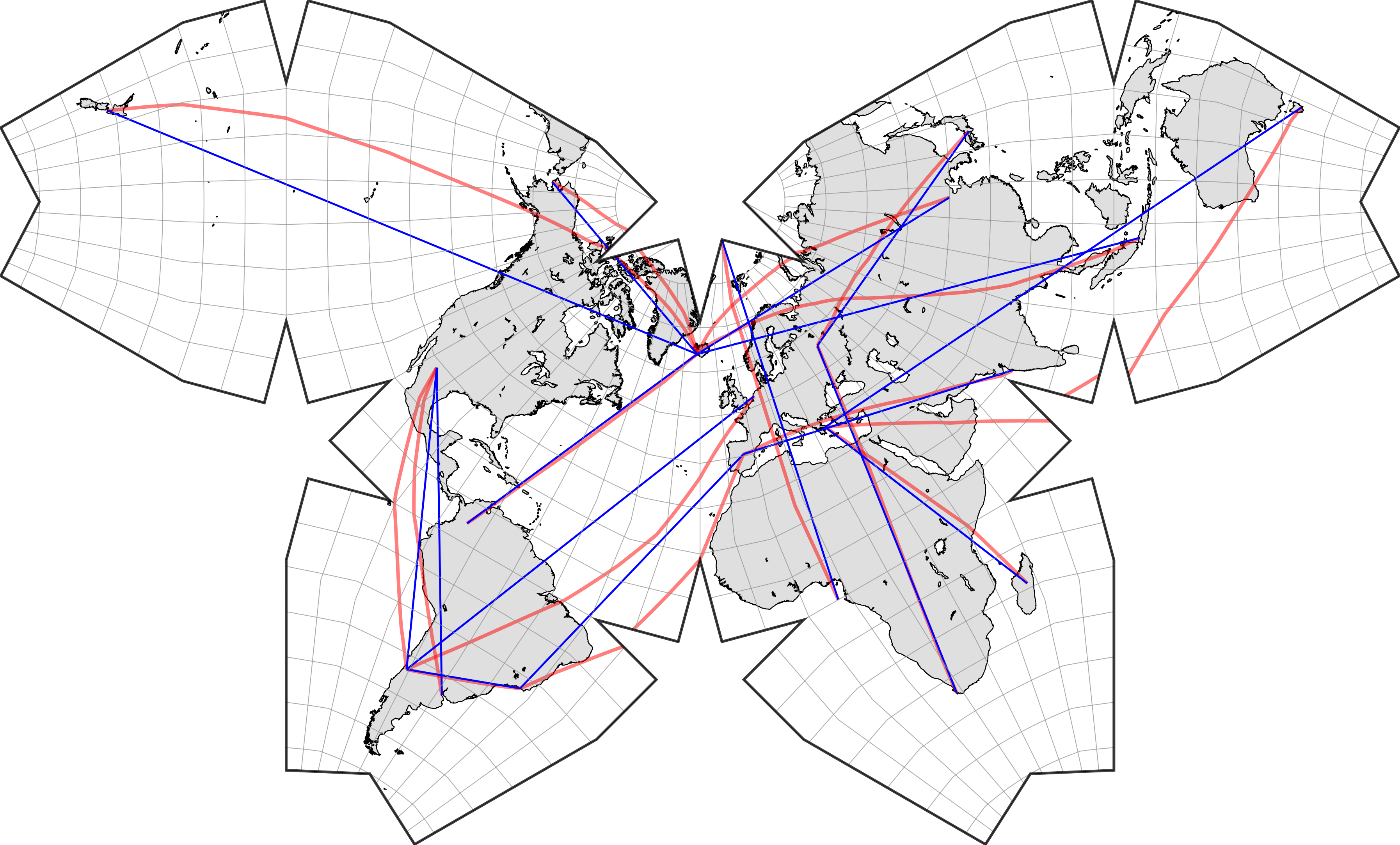 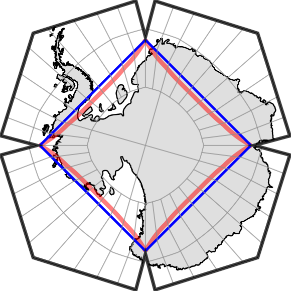 Waterman |